
Buckhorn Creek's dam removal in Michigan has moved from construction to a public conversation about what restoration should deliver. A Muskegon River Watershed Assembly update published on 5 October 2026 records board chair Michael Gabrion's remarks at the late-September ribbon cutting. The physical reconnection was already achieved earlier in 2026; the October update is a recent account of community stewardship, not news that the dam was removed this month.
For anglers and other river users, the important change is a reopened connection between a tributary and the larger Muskegon system near Paris in Mecosta County. The next question is how that connection functions over time. Construction completion is a substantial achievement. It also marks the point at which monitoring, maintenance and public understanding become especially important.
The project and its actual timeline
The assembly's project page gives a clear sequence: planning began before 2025, construction started in May 2026, free flow returned in June, and the White Pine Trail reopened over a new bridge in September. It lists monitoring and impact evaluation as future work. That chronology prevents an autumn celebration from being mistaken for the date of the initial river reconnection.
The same project page describes 2.4 miles of cold-water resources made accessible and $2.2 million in committed funding. These are the project organizer's figures. Stream length is an access measure, not a count of fish using the route. Committed funding is not a finding about audited final expenditure, cost savings or local economic returns.
The most useful way to read that record is as a set of separately testable milestones. Planning, construction, access and ecological response do not have to occur on the same day. A project can have completed its engineering phase while still having important biological questions to answer.
What independent local reporting confirms
WCMU Public Media reported the reconnection on 18 September 2026. Its account corroborates the dam removal, work on the creek's banks and shoreline, and installation of a 90-foot bridge. Reporter Minnie Bardenhagen interviewed assembly executive director Paul Haan, who explained the importance of cold tributaries as places fish can seek refuge when the main river is warmer.
That is a reliable, attributed local explanation of the project's purpose. It is not a published before-and-after temperature series or a fish-population assessment. The reporting supports the conclusion that a physical barrier has been removed and that habitat access motivated the work. It does not establish how many fish survived a warm period because of the removal.
For the fishing community, this is a more useful distinction than a promise of improved catches. The value of a tributary connection can concern where aquatic organisms are able to move, even when there is no evidence yet of an increased catch rate at a particular fishing spot.
September's celebration and October's message
The assembly's September release announced a ribbon cutting for 25 September and invited volunteers for stream sampling and planting on 26 September. Those invitations document intended community activities; they do not, by themselves, establish attendance, the number of plants installed or the results of any samples.
The 5 October account confirms that a late-September ribbon-cutting event provided the setting for Gabrion's remarks. His emphasis was on responsibility beyond the engineering work: people had reopened a pathway and created an opportunity for restoration. We paraphrase that published perspective rather than presenting it as a new interview with this journal.
An important editorial reading of that message is that stewardship extends beyond celebration. A bridge and a newly open channel are visible achievements. The less visible work is explaining how the site will be observed, cared for and discussed after public attention moves elsewhere. That does not diminish the milestone; it makes the next stage intelligible.
Passage, habitat use and population change are different outcomes
A useful assessment would separate three questions. Can organisms pass the former obstruction? Do they use the newly accessible area? Does that use contribute to sustained improvements in the population or wider ecosystem? A convincing answer to one question should not automatically be used as the answer to all three.
The assembly's release includes an observation by Haan of fish waiting to move upstream during channel testing. Such an observation is encouraging, but it is an attributed field observation, not a standardized abundance estimate. It supplies a reason to investigate use of the connection, not a numerical measure of recovery.
This article does not identify a single fish species as the sole beneficiary. The project concerns stream function, aquatic connectivity and community infrastructure. It would be misleading to attach an unsupported species-specific recovery claim to a project whose checked public material describes broader habitat aims.
What monitoring guidance contributes
NOAA's March 2022 Restoration Center implementation-monitoring guide offers a useful framework for understanding the evidence. For barrier-removal work it separates site passability, presence of target fish, infrastructure or community changes, and other implementation measures. It emphasizes defined targets and comparable pre- and post-project observations.
We use that document as a methodological reference, not as evidence that NOAA funds Buckhorn or that every NOAA grant condition applies here. The guide illustrates why a photograph of flowing water cannot answer every ecological question. Physical dimensions, observations of organisms and records of public infrastructure each describe different parts of a project.
Our practical recommendation for future Buckhorn updates is straightforward: publish the question being tested alongside the result. “The connection remains open” and “a surveyed species was present upstream” are understandable findings when accompanied by dates and methods. Neither needs to be inflated into a claim that the entire watershed has recovered.
Another river shows why comparisons need care
NOAA's 8 June 2021 account of research following dam removals on Maine's Penobscot River describes coordinated monitoring before and after intervention. The work covered river form, water quality, fish movement and biological communities. Its reported improvements were based on observations gathered across years, rather than on a single opening ceremony.
The same account connects relatively minor channel and sediment changes there to the characteristics of the removed dams, including limited sediment storage. That qualification is important. A result in one river is not a prediction for every other dam-removal site. Differences in setting and design affect which comparisons are useful.
The transferable lesson is the approach to evidence: establish what the site was like, document what was built or removed, and examine the response. We do not transfer Penobscot fish numbers, recovery rates or species outcomes to Buckhorn. They would be measurements from a different river, involving different organisms and project conditions.
How to read the next Buckhorn update
Look first for a clear date and a description of the observation. A channel inspection, a vegetation check and a biological survey should not all be labelled simply “monitoring” without explanation. Readers should be able to tell whether an update concerns the structure, the surrounding habitat or organisms using the creek.
Next, ask what comparison supports the conclusion. Is it an earlier observation at the same location, a design target, a reference location or a professional assessment with stated limits? An unexplained claim of improvement is harder to evaluate than a modest result whose basis is clear. A finding that still needs investigation can be valuable if it is reported honestly.
Finally, look for the next decision. If an observation prompts additional maintenance, another survey or a change in how the site is managed, explaining that response shows how evidence is being used. These are our suggested acceptance checks for public reporting, not a claim that Buckhorn has failed them or that its managers have promised a particular reporting timetable.
What a responsible visit can contribute
A visit can help people understand the relationship between the trail crossing and the creek, but it should remain a visit rather than an improvised survey. Use established public routes, respect signs and any work areas, and avoid walking onto recovering banks to obtain photographs. Do not move rocks, disturb vegetation or handle wildlife as a way of testing the restoration.
If a visitor notices something concerning, a dated photograph from a safe position and a clear description of the location can be more useful than a dramatic conclusion. Report the observation to the responsible organization through its published contact route. Separate what was seen from what is suspected; a muddy patch, for example, does not by itself establish its cause.
This conservation article is not a fishing-access authorization or a current catch-and-retention guide. Verify the applicable water-specific fishing rules and lawful access before fishing. No change in fishing limits is announced here, and the reopening of ecological passage should not be read as a new permission to use every adjoining bank.
The milestone after the milestone
Buckhorn now has a documented physical reconnection and a recent community account that frames it as a continuing responsibility. The public project page's next stage—monitoring and evaluation—is therefore the most consequential development to watch. It should help distinguish an available pathway from demonstrated habitat use and, eventually, any measured longer-term benefit.
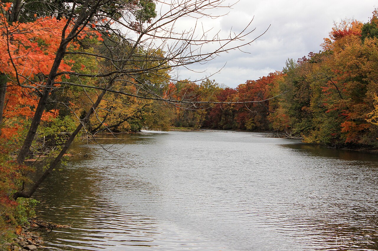
The cover is Marc Steensma's October 2012 photograph of the Muskegon River near Newaygo. It provides historical watershed context and is explicitly not a photograph of the Buckhorn works, a construction record or a before-and-after comparison. Keeping that distinction visible is part of reporting a restoration accurately.
Sources were checked on 23 October 2026. This is desk reporting and analysis with AI assistance. We have not visited the site, interviewed the project team or independently measured fish abundance, temperature, sediment or vegetation. The verified achievement is substantial without adding those unmeasured claims.