
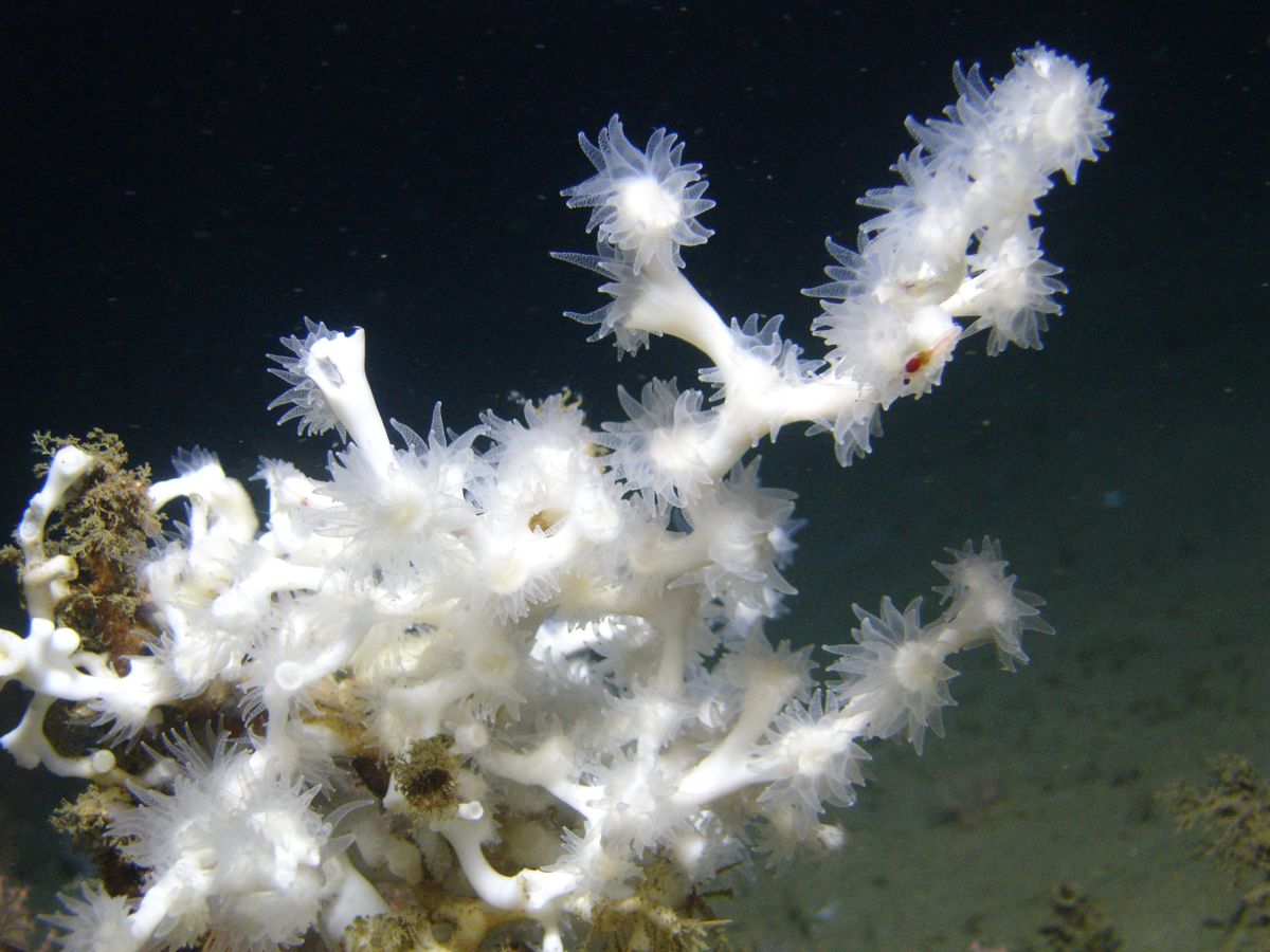
The Open Ocean Trustees announced five-year extensions for a linked group of deep-seafloor restoration projects on 22 October 2026. The work addresses habitats injured by the 2010 Deepwater Horizon oil spill, combining mapping, protection, coral techniques and assessment. The announcement supports continued work; it does not establish that the affected communities have recovered.
There is an important distinction between announcement and adoption. The three newly highlighted resolutions record 10 September 2026 as their last-signature date. An earlier assessment-project resolution records 26 February 2026, although the October announcement refers to that extension as a March development. The public update is recent, while the underlying decisions were made earlier.
Those dates matter because a reader should be able to tell whether a story describes a proposal, an approved action or an ecological result. Here, the extensions are approved actions documented in resolutions. Their eventual restoration benefits remain a subject for monitoring.
Four linked jobs, different kinds of evidence
The Mesophotic and Deep Benthic Communities program concerns habitats below the familiar shallow-water reef setting. The projects do not all perform the same task. One gathers and interprets spatial information, another addresses threats, another develops coral-restoration techniques, and another evaluates habitat and response.
The October announcement lists increases of $12.5 million for active management and protection, $10 million for mapping and modeling, and $21 million for coral propagation techniques. That is $43.5 million across the three September decisions. The earlier assessment increase is $12.5 million, bringing the four extensions to $56 million in additional authorized budgets when considered together.
These totals describe authorizations. They should not be presented as money already spent at sea, a count of completed restoration sites or a new award made entirely on 22 October.
| Work stream | Main question | Useful evidence | Claim to avoid |
|---|---|---|---|
| Mapping and ground-truthing | Where is relevant habitat? | Verified maps and field observations | Every predicted patch is confirmed coral |
| Active management and protection | Which threats can be reduced? | Documented intervention and follow-up | A threat disappears permanently |
| Coral technique development | Which approaches persist? | Survival, growth and recruitment observations | Deployment equals recovery |
| Habitat assessment | How do conditions change? | Comparable monitoring through time | One survey establishes a trend |
The table is an editorial guide to interpreting the program, not a substitute for the project implementation plans.
Mapping makes the next decision less blind
The mapping resolution combines acoustic surveys with direct checks and model refinement. A map can narrow the places where restoration teams should look, but a predicted habitat class remains different from a confirmed biological community.
Ground-truthing is the link between those two kinds of information. A seabed feature may have a shape or acoustic response associated with useful habitat, yet cameras or other observations are needed to see what actually occupies it. That distinction is particularly relevant when a restoration decision depends on avoiding damage to existing communities.
The added mapping budget increases that project's authorized total to $45.909 million. It does not translate directly into a particular area restored. Survey coverage, map resolution and biological confidence are separate measures, and each answers a different management question.
For fishing readers, better spatial knowledge can help explain why a particular area matters. It is not automatically a new public fishing map or permission to visit a restoration site. Publishing a habitat prediction without its uncertainty could encourage the wrong kind of use.
Protection is more than putting new material down
The active-management resolution increases that project's authorized budget to $33.189 million. Its scope includes assessing and reducing threats, communicating evidence to managers and working with resource users. These are interventions intended to protect habitat alongside more direct restoration.
The attached plan describes such approaches as mooring-related protection, marine-debris and derelict-gear work, and assessment of other seafloor threats. This is a range of authorized activities, not proof that every listed action has already been completed at every site.
A useful evaluation asks whether the intervention reduced the actual pressure. Installing a mooring, for example, and measuring a reduction in damaging anchoring are related but separate observations. The installation is an output; changed use and reduced damage would be evidence of effect.
Debris work needs a similarly careful interpretation. Removing material can be beneficial, but the operation must avoid causing greater damage during retrieval. A high removal count alone cannot capture that balance. The project documents recognize the need to assess suitability rather than treating every object as an uncomplicated recovery target.
Coral propagation remains a technical challenge
The coral-technique project has the largest of the three September budget increases. Its documentation distinguishes several kinds of structures and uses, including temporary testing, nursery functions and longer-term substrates. These are tools for learning and restoration, not interchangeable objects that produce the same outcome wherever placed.
The plan notes limited success with recruitment of target species on specialized substrates and the need for more knowledge of reproductive biology and settlement preferences. That limitation is essential context. It would be misleading to describe the extension as confirmation that a universally reliable deep-coral method has been solved.
A coral surviving after deployment is encouraging, but the interpretation depends on the observation period and condition of the colony. A short-term survival count does not establish long-term growth, reproduction or recovery of the wider community. Nor does a photograph of a coral show how the unphotographed deployments performed.
This is why a staged approach can be informative. A smaller test can reveal a site problem before a larger deployment commits more material and effort. That is a general interpretation of adaptive restoration, rather than a prediction that every test will lead to scaling up.
Assessment supplies the comparison through time
The earlier habitat-assessment extension keeps observation and evaluation connected to the intervention work. Without comparable records, it becomes difficult to separate project effects from ordinary variation, new disturbance or changes in how teams collect data.
Imagine two surveys using different camera coverage. More observed coral on the second survey might reflect wider coverage rather than growth. Conversely, a smaller count after rough conditions might reflect visibility or an altered route. Consistent methods and transparent differences help prevent those mistaken conclusions.
A useful future report should identify what was measured, where, at what intervals and with what uncertainty. It should also distinguish an untreated reference area from a treated area where that comparison is feasible. These are evaluation questions raised by this journal, not claims that a specific study design has already been completed.
The resolutions and plans provide the approved framework and the trustees' stated rationale. They are not an independent external audit of every reported achievement. This article has not added firsthand observations, interviews with fishing crews or a new analysis of raw survey records.
Why a longer program may be useful
An extension can preserve trained teams, equipment arrangements and knowledge built during earlier work. It can also allow repeated observations beyond the first deployment. These are plausible advantages of continuity, while their value still needs to be demonstrated through the work delivered.
Longer duration does not eliminate uncertainty. A method that works at one depth or on one substrate may fail elsewhere. A successful local intervention can coexist with continued damage from another pressure. That is a reason to evaluate distinct work streams together without merging all their results into one broad success label.
For anglers, the practical implication is to follow documented habitat guidance and management notices rather than assume improved fishing immediately. A restoration decision does not itself amend seasons, bag limits or access restrictions. Any such change requires its own adopted measure and current official notice.
The next milestones worth reading
The next useful public updates would connect the approved extensions to specific work: new verified mapping products, clearly located threat-reduction activities, coral deployment and follow-up results, and comparable habitat assessments. Each should give dates that let readers distinguish fieldwork from the later publication of a summary.
Budget reporting should likewise separate authorization, commitment and spending. Ecological reporting should separate attempted treatments, completed work and measured response. Keeping those distinctions visible makes progress easier to assess and setbacks easier to learn from.
The verified October development is continued institutional and financial support for an interconnected restoration effort. Whether it produces lasting gains for deep-seafloor communities is the question the extended program must answer through evidence.