
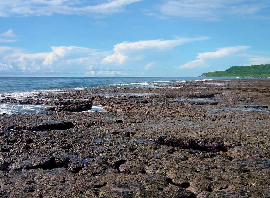
Guam’s reef flats can appear inviting from shore: clear water, visible channels, dark coral edges and a surf line marking the drop into deeper Pacific water. That visibility can create false confidence. The same platform may contain sharp limestone, living coral, sudden holes, strong exchange through channels and a fast-changing route back to land. Some of the most attractive water also lies inside marine preserves with method and species restrictions.
A first trip should therefore be built around legal access, reef protection and a retreat plan before it is built around a target fish. This guide treats Guam shore fishing as a mixed reef and harbour-edge activity. It does not promise a seasonal catch or substitute for the Guam Department of Agriculture’s current rules.
Check the exact place, not just the island
Guam’s fishing regulations include marine preserves with different provisions. The official rule document says that Tumon Bay generally prohibits fishing except for specified methods, including limited hook-and-line and cast-net fishing from shore, with the shore take restricted to named groups such as rabbitfish, juvenile goatfish, juvenile jacks and convict tang. It describes other preserves, including Piti, Sasa Bay, Anae and Achang Reef Flat, as prohibiting fishing except for methods specifically allowed by law or regulation. At Pati Point, hook and line from shore is among the stated exceptions.
Those examples demonstrate why “shore fishing is allowed” is not a sufficient legal check. Confirm the boundary on a current official map, the method, species, size or season provision, and whether the precise access point is open. A legal method in one preserve can be prohibited or more limited in another. Rules may also differ between territorial waters and the federal waters generally beginning farther offshore.
Read the current Guam Department of Agriculture material shortly before the trip and contact its Division of Aquatic and Wildlife Resources when a boundary or species name is uncertain. Do not rely on a resort description, a pin shared online or the behaviour of another angler. If the spot cannot be confidently placed outside a closed area or within a specific lawful exception, choose a clearer location.
Understand the reef-flat route
A reef flat is not simply a beach exposed at low tide. Water drains and returns through cuts, gutters and channels. Coral rock can be undercut, loose or coated with algae. The outer edge receives breaking waves even when the inner flat looks quiet. A low tide can reveal a route that disappears long before an angler expects.
Study the shoreline in daylight. Identify the entry, the highest safe path and two retreat lines. Mark any channel that must be crossed. If water is already moving strongly across the ankles on the outward walk, the return may be more difficult. Do not step on living coral or cross a fragile area for casting distance.
Harbour and seawall positions remove some reef-walking risk, but add their own hazards: deep vertical water, vessel traffic, mooring lines, slippery steps and rules around port infrastructure. Check posted restrictions, remain clear of working areas and select a landing point before casting.
Use tide information as a planning tool
NOAA Tides and Currents provides observations and predictions for Apra Harbor station 1630000. A station prediction describes water level at that station, not the exact timing or depth on every reef. Wind, waves and local geometry alter what an angler experiences. Use the table to frame the session, then confirm conditions at the chosen shoreline.
For a first visit, avoid building a plan that requires walking far onto the flat at the lowest water. A safer session stays near shore, fishes a gutter or harbour edge and ends before the return route becomes questionable. Arrive early enough to watch the direction and speed of change.
Moving water can concentrate food near channel mouths, coral edges and points, but it also increases line drag and footing risk. Fish from stable ground across the seam rather than standing in the strongest flow. When a wave set begins reaching higher than the previous sets, retreat immediately.
Read the marine forecast and surf
The National Weather Service office in Guam publishes coastal-waters and surf forecasts for the Marianas. Its local criteria recognize that hazardous small-craft conditions can involve strong wind and high combined seas. A shore angler should act well before an advisory threshold becomes the only reason to stop.
Check the marine and surf forecast before departure and again at the coast. Note wind direction, wave height, thunderstorm risk and any high-surf or small-craft product. Offshore wind can make the inner water look smooth while creating other risks; onshore swell can send occasional larger waves across the reef edge.
Never turn your back on the sea. Fish with a partner where possible, tell another person the location and return time, and carry communication in a waterproof case. Wear reef-safe footwear with secure soles. A personal flotation device is sensible around deep channels, breakwaters and steep harbour walls. Stop when lightning threatens, darkness approaches or the retreat line changes.
A practical mixed-reef outfit
A medium-light spinning rod around 2.1 to 2.7 metres with a 2500- to 4000-size reel covers many shore situations without encouraging dangerously long casts. Main line around 10- to 20-pound braid and a 15- to 30-pound abrasion-resistant leader provide a reasonable starting range. Use the lighter end in open water and the stronger end near coral or rock.
Carry a small selection rather than a heavy pack. Metal jigs of roughly 10 to 30 grams, sinking minnows, small surface lures and soft plastics on appropriately weighted heads can explore different depths. Match lure weight to the rod, wind and current. A lure that cannot be controlled is too light; a lure that crashes repeatedly into coral is too heavy or being worked at the wrong angle.
If bait is lawful at the site, a simple running-sinker rig keeps the presentation close to bottom. Use enough weight to hold briefly, not to anchor permanently in coral. Circle hooks can reduce deep hooking when matched to bait and species, but they do not make an unlawful species or location acceptable. Verify bait collection and use rather than gathering organisms from the reef.
Take long-nose pliers, a compact landing net where it can be used safely, spare leader, a line cutter, water, sun protection and a small rubbish container. Avoid a stringer or loose bucket where a wave can remove it. Do not bring more gear than can be carried during a quick retreat.
Fish the edge without feeding the reef line
Start with casts parallel to a channel or darker edge. A lure moving along structure remains visible to fish for longer than one pulled quickly away from it. Keep the rod tip high enough to steer line over shallow rock, then lower it when the lure reaches deeper water.
With a small jig or soft plastic, let the lure sink under controlled tension and use short lifts. Count the descent so a productive depth can be repeated. Stop the drop early if contact with coral becomes frequent. With a minnow lure, use a steady retrieve and occasional pause. Surface lures can reveal activity above shallow structure when conditions and rules allow.
Do not cast directly over living coral if a hooked fish will inevitably cut the line across it. Move to an angle that offers a clean route. When snagged, pull from different safe angles or break the leader without entering dangerous water. Lost tackle is harmful; prevention is better than attempting a risky recovery.
After ten to fifteen minutes without a follow, strike or bait sign, change depth or move to the next legal feature. Reef fish are often associated with small zones of current, shade or relief. Repeating the same cast over bare flat rarely improves the evidence.
Identification, handling and food caution
Guam’s reef fish diversity makes identification part of legal compliance and safety. Learn the species that may lawfully be taken at the exact location, including local and English names used in official material. Do not identify a fish only from colour; body shape, fin placement, mouth, spines and markings all matter, and colours may change after capture.
Some tropical fish have sharp spines, teeth or venomous structures. Use tools rather than bare hands when uncertain. Keep the fish supported and away from dry rock. If release is lawful, minimize air exposure and return it promptly in water deep enough to swim. If a fish cannot be identified with confidence, do not retain it.
Food safety cannot be reduced to whether a fish is legally takeable. Ciguatera risk occurs in tropical reef food webs and is not detectable by appearance or normal cooking. Seek current local public-health advice before retaining reef fish, especially larger predators, and follow any species or area advisory. A fishing guide cannot certify a particular fish as safe to eat.
Reef care and community respect
The Guam Department of Agriculture describes marine preserves as part of managing and restoring reef resources. Fish as a visitor to a living system and to places with deep community importance. Do not stand on living coral, remove coral, leave monofilament or disturb wildlife for a photograph. Use established paths and avoid blocking local access.
Rinse mud and organic material from footwear and gear before moving between waters. Pack out every hook, leader clipping and bait wrapper. If line is found where it can be reached safely, remove it. Give other fishers space and ask before crossing an established casting line.
Common mistakes
- Assuming every marine preserve follows the same shore-fishing exception.
- Using a tide time without watching the actual return route.
- Walking to the outer reef because the inner flat looks calm.
- Fishing too light to control line around coral, then leaving broken tackle.
- Treating a colourful reef fish as identified without checking diagnostic features.
- Retaining a fish without confirming both legality and current food-safety advice.
- Carrying so much gear that a quick retreat becomes difficult.
A conservative first session
The day before, select one clearly legal access point and one backup. Save the Department of Agriculture contact and rule pages, review the current preserve boundary, check the Apra Harbor tide window and read the NWS marine and surf forecasts. Pack one rod, a few lawful lures or a verified bait rig, leader, pliers, safety gear, water and sun protection.
Arrive in full daylight and spend ten minutes observing before rigging. Fish the nearest safe channel or edge for one tide stage. Move only when the route remains obvious. Stop early enough to leave without hurry, then record wind, surf, water level, clarity, productive depth and any species confidently identified.
That modest plan may produce fewer casts than a long reef walk, but it produces better information and a larger safety margin. On Guam, the best first trip is the one that respects the preserve boundary, protects coral and ends before the ocean chooses the route home.