What changed in September 2026
A field assessment published by the River Restoration Centre on 23 September 2026 provides a useful check on the River Breamish restoration at Harehope Estate in Northumberland. Its observers reported that floods had widened the excavated meanders and redistributed gravel. They also encountered very low water after drought and green pools suggesting continuing nutrient pressure. This is an account of a river adjusting after intervention, with remaining problems visible alongside progress.
The timing matters. The Environment Agency and Natural England announced completion on 20 November 2025. September's account is a subsequent professional site-visit report, rather than a newly completed construction project or a controlled study demonstrating that salmon numbers have recovered. The journal has not visited the site. This article separates the partners' documented work, the later observations and our interpretation of the questions that monitoring must now answer.
Reconnecting a river that had lost room
The Environment Agency's November 2025 account describes centuries of agricultural modification that straightened the Breamish and disconnected it from its floodplain. The partners used historical maps and modern terrain information to trace former channels. They reported salmon and sea trout moving through the restored reach towards spawning grounds. Those fish observations belong to that earlier account; they are not a new September 2026 population estimate.
The agency's March 2026 explanation adds an important design principle. Historical evidence, including maps held at Alnwick Castle, helped guide the intervention, but the intention was to restart river processes and leave space for continued adjustment. Rebuilding a particular map outline was therefore a means of reopening possibilities for flow and habitat, rather than a promise that every new bank would remain fixed indefinitely.
For anglers, that distinction changes how success should be judged. A newly excavated channel can look finished while remaining biologically immature. Conversely, a gravel bar that changes after a flood does not automatically indicate failure. The useful questions concern whether the movement is occurring within the agreed space, whether habitat diversity is developing and whether important species can use the resulting system through difficult seasons.
What the physical totals actually describe
The Environment Agency's 2025 river-basin delivery case study gives separate measures of the intervention: approximately 1.6 kilometres of floodbanks breached or removed, 1.5 kilometres of river remeandered and 20 hectares of floodplain reconnected. It also records priority-habitat and native-woodland work. These are different types of output, and they should not be added together as though they measured one continuous length of new river.
A hectare reconnected to floodwater is a physical achievement. It is not a hectare proven to produce a specified number of juvenile salmon. Likewise, an accessible channel does not demonstrate how many fish survived their first summer or eventually returned from the sea. Keeping the units separate prevents an attractive restoration headline from silently becoming a claim about stock recovery.
Our assessment is that the next stage should connect these physical outputs to explicit ecological questions. Which areas retain water during dry periods? Which provide refuge during high flows? Where do young fish feed, shelter and move? The answer may differ between seasons and species, so one photograph or one successful passage observation cannot stand in for the entire evaluation.
The lamprey tradeoff deserves attention
September's River Restoration Centre report describes wooden structures encouraging water into the reactivated former channel and willows helping stabilise the arrangement. It also explains a constraint: the old, straightened channel has developed still, silty habitat used by lampreys. Moving all the water away from it could sacrifice an existing ecological function. The report therefore reveals a management tradeoff within restoration, not simply a choice between an entirely good new channel and an entirely bad old one.
The Joint Nature Conservation Committee's River Tweed Special Area of Conservation profile helps explain the wider context. Atlantic salmon are an important selection feature, and sea, river and brook lampreys are also qualifying features. That designation profile documents conservation interests; its historical descriptions are not a current assessment of fish abundance in the Breamish.
This is a practical reminder that fish conservation cannot be assessed solely through the preferences of the most prominent sport fish. A design that helps one life stage or species may need adjustment to retain another habitat. The appropriate response is to state those objectives openly and monitor both, rather than treating a compromise as evidence that the project has abandoned restoration.
Drought and nutrients remain separate tests
An evaluation of resilience needs more than a comparison of photographs. Floodwater and dry weather can expose different weaknesses in the same design. A physical change that appears promising under one condition must still be assessed under others, using measurements appropriate to the question.
LIFE WADER's project documentation describes the monitoring tools available to investigate the restoration. They include water-quality sondes, water-level sensors, sediment samplers, ecological and vegetation surveys, and repeat photography from fixed positions and drones. This combination can examine changes that a visitor sees and processes that are not obvious from the bank. The existence of the equipment, however, does not establish that every desired benefit has already been measured.
A useful interpretation framework is to separate exposure, response and cause. A sensor can document what conditions occurred. Repeated surveys can show how habitat or fish use changed. Attributing those changes to the restoration requires attention to rainfall, flow, temperature, upstream land management and other differences between sampling periods. Without that separation, a wet year can be mistaken for project success and a dry year for failure.
The land agreement is part of the habitat
The project partners identify long-term cooperation with the landowner and Countryside Stewardship support as central to making space for the river. LIFE WADER describes a 20-year management arrangement and years of discussion before delivery. This is important context for anyone hoping to reproduce the approach: the excavation is only one part of the intervention, and an agreement to tolerate a changing landscape is another.
In our view, the durability of that arrangement should be treated as an ecological dependency. If the river is intended to develop lateral channels and periodically occupy its floodplain, future management must be compatible with those processes. Repeatedly forcing it back into a single narrow corridor would change the experiment being evaluated. Maintenance decisions therefore need the same clear objectives as the original work.
The Environment Agency's March account presents landowner cooperation as a potential influence on neighbouring projects. That is a plausible pathway for wider change, but it is not evidence that every neighbouring proposal has been funded, consented or completed. A demonstration can inform another scheme while still requiring a new local assessment of land, infrastructure, habitats and affected people.
Do not merge neighbouring schemes into one success story
Tweed Forum's Breamish and Pow Burn project page describes work associated with the nearby Hedgeley scheme, including reconnecting channels and wetlands, modifying artificial banks and using woody material. It also describes environmental planning and safeguards. This is relevant evidence of how restoration approaches can be developed within the catchment. It should not be used to relabel Harehope's completed outputs or to assert that an anticipated construction window proves completion elsewhere.
The distinction matters for accountability. If a reader asks whether a particular area was reconnected, the answer needs the correct site and reporting date. Adding the area of one scheme to the benefits forecast for another can create a larger but meaningless total. The same care is needed with programme budgets: a multi-project budget is not automatically the cost of this individual river reach.
What anglers can do without disrupting the work
A restored river can offer useful lessons in reading water, but conservation interest is not permission to fish or enter private land. JNCC explicitly notes that designation does not itself provide public access. Before visiting, establish the permitted route and obtain any fishing permission required by the landowner or fishery. Check the appropriate current fishing rules separately; this article announces no season, licence exemption or new access right.
If access is authorised, observations can be more useful when they are repeatable. Note the date, broad flow conditions and a fixed viewpoint. Record whether a side channel is connected rather than describing it only as looking healthy. Report suspected pollution or an apparent passage problem through the relevant authority or project contact. Avoid entering fragile banks, disturbing spawning areas or rearranging wood to improve a casting position.
These suggestions are our practical interpretation of the project's monitoring needs, rather than a request from the project for unsupervised surveying. Volunteers should join a coordinated activity with a clear method and permissions. An inconsistent collection of sightings can identify questions, but it should not be presented as a statistically reliable population trend.
The evidence to look for next
The River Restoration Centre's monitoring guidance recommends setting measurable objectives and matching monitoring to a project's scale, complexity and risks. Applied here, that means following more than the appearance of the channel. Useful future reporting would distinguish physical stability and adjustment, water conditions, habitat use and fish population responses, with the sampling dates and methods supplied.
Several results would answer different questions. Repeated use of a channel would strengthen evidence of connectivity. Persistent juvenile occupancy would indicate habitat use. Survival estimates and repeated age classes would provide a stronger basis for population claims. None alone would establish that every remaining pressure in the wider catchment or marine phase had been resolved.
The September assessment already contributes something valuable: a dated account of progress that also records drought, nutrients and the need to protect lamprey habitat. The next conservation milestone should be evaluated against those unresolved questions. A river given space to change needs a monitoring programme willing to describe both the changes that help and the compromises that remain.
Image and reporting note
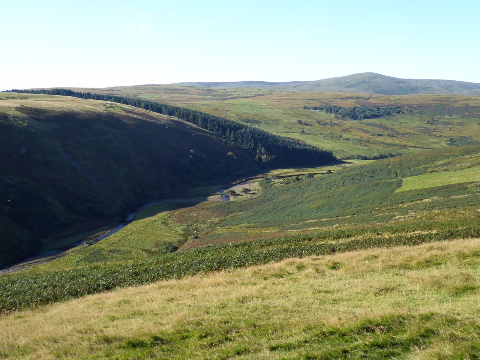
The cover is Russel Wills's photograph of the River Breamish near Ingram, taken on 29 September 2020 and used under CC BY-SA 2.0. It provides catchment context; it does not show the Harehope works or a measured restoration outcome. Source documents were checked on 20 October 2026; older documents supply historical and methodological context, and the current reporting milestone is the 23 September field assessment.